


Roca London Gallery
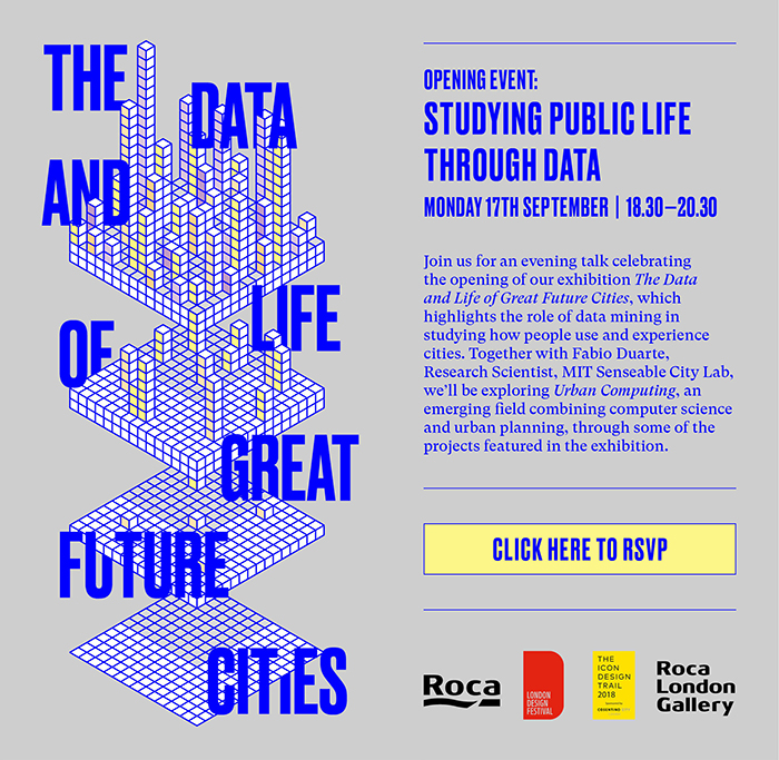
BCFA member Roca will be presenting their London gallery’s autumn exhibition “The Data and Life of Great Future Cities” on 17th September, coinciding with London Design Festival. The theme of this gallery proposes that, used responsibly, personal data could be the key to a better urban design. This follows on well from their launch of a new digital platform project, inviting discussions relating to global issues, such as the life of oceans.
You can click here for more information about the event, or click here for exhibition information!
“As an organisation that values innovation and invests in the future, the subject of big data – and using personal data to improve urban living – is extremely exciting to Roca. This exhibition shows the powerful yet positive side of data sharing, demonstrating how it can be of benefit now and in years to come.” – Caroline Kilgour, Programme and Communications Manager at Roca London Gallery
 Data has had a really bad press recently. The combined effects of the GDPR ruling and the Cambridge Analytica scandal have brought issues around data security and privacy policies to the forefront. People have been deleting Facebook accounts and cookies that allow personalization of online advertising that is a gateway to data gathering. Can data collection actually be good for us?
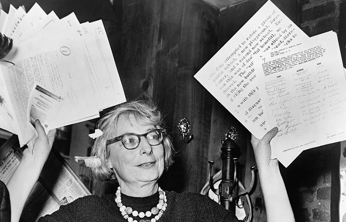
The exhibition title is inspired by the now iconic 1961 book “The Death and Life of Great American Cities”, by pioneering urbanist, activist and writer Jane Jacobs. Controversially, without extensive evidence gathering, Jacobs managed to identify the four conditions required for successful city planning – otherwise known as the “four generators of diversity”.
Her theories have now been proved uncannily accurate by a team of researchers at The University of Trento, led by Marco De Nadai, whose work will be part of the Roca London Gallery show. De Nadai’s development of a much cheaper and quicker alternative to the lengthy and costly collection of survey data uses a new generation of city databases, such as OpenStreetMap and Foursquare combined with mobile phone records showing the number and frequency of calls in an area, to identify a city’s most vibrant areas.
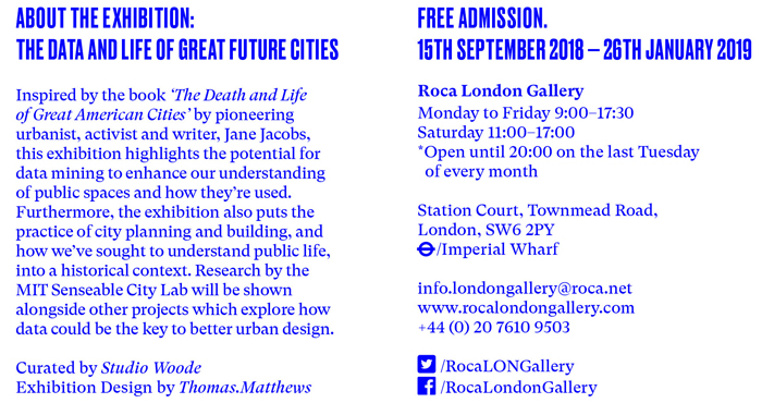
“By studying these projects, in which data mining essentially becomes a new tool to learn about how people use and perceive cities, we’ve found that researchers are progressing the tradition of urban observation pioneered by Jane Jacobs, albeit with modern technology and on a massive scale. Through this exhibition, we’ve wanted to highlight these new tools, and also tried to put contemporary approaches to studying a city at street level into historical context.” – Eva Woode, exhibition curator.
The show’s opening section will review historical approaches to urban design, dating back to ancient times when city planning could as easily be victim to the whim of a dictator as configured to honour a spiritual figure.
Tools for studying cities now and how we might adapt them for the future will be illustrated through a number of projects, including two current examples from MIT’s Senseable City Lab, led by Carlo Ratti: Friendly Cities and Treepedia.
“Our research shows that using aggregated, anonymised data – which is already being generated and collected, for example, whenever we use our smart phones – opens up new possibilities of designing cities that are better adapted to human needs. For instance, all smartphones have an embedded accelerometer that can measure effects such as bridge vibrations. Given that, in the United States alone, thousands of bridges have infrastructural problems, ‘opportunistic’ data gathering from smartphone-carrying drivers provides an invaluable real-time bridge monitoring system. This is where big data starts to solve big problems!” – Fábio Duarte, Research Scientist, MIT Senseable City Lab.
Friendly Cities is based on a Singapore-based study, where personal data is less tightly policed than in the UK. By extracting information from mobile phone data, MIT Lab can demonstrate how, as people move about the city, they either ‘bond’ through deliberate connectivity with friends or ‘bridge’ via chance encounters with strangers. This has enabled them to map places in the city that bring people together.
Using Google Street View data, Treepedia allows the comparison of tree canopies in cities around the world. A city’s tree canopy affects urban temperatures and mitigates air pollution, while the trees’ absorptive root systems help to avoid floods during severe rains and storm surges. Importantly, there are also proven health benefits to living within view and shelter of greenery.
Why not click here for more information about the event, or click here for exhibition information?
Contact Roca